Spring storm on course for the weekend.
QUICK FIRE SUMMARY.
On Saturday an active front approaches the South Island from the Tasman, bringing a period of strong to gale force northerlies, before turning severe gale nor-westerly on Sunday across most of Canterbury. This front will bring heavy & significant rainfall to the Main Divide & Canterbury Headwaters, before easing Sunday afternoon and turning to snow at lower levels.
Colder south-westerlies will continue through Monday, bringing more showers, hail & thunderstorm risk and snow to parts of the region.
Please note, we’re still a few days out and can expect slight adjustments in rainfall totals, snowfall accumulations/levels and of course the all important ‘timings’.
WINDS.
At this stage severe northerlies and nor-westerlies will be widespread affecting the entire region at various levels of intensity over the weekend, possibly peaking Sunday morning. Winds may exceed 130km/hr across the Canterbury Plains and even stronger about higher elevations. Winds of this force may cause damage to trees, power lines and make driving hazardous, especially about inland areas, with elevation.
RAIN.
More significant rainfall is likely about the Main Divide & Headwaters, with torrential rain at times, rates may exceed 20mm/hr, with grand totals in excess of 200mm. Our main river systems will be running high. Flooding and slips are possible about the Mt Cook & Arthur’s Pass National Park.
SNOW.
Winds tend south-westerly late Sunday, with snow lowering to lower levels. Heavier and more sustained falls are likely about the Main Divide & Canterbury Headwaters. Snow is likely to affect the Arthur’s & Lewis Pass and a number of our higher villages. A road snowfall warning is likely over the next 48 hours. Colder temperatures will dominate our Monday, with shower risk, there is also the risk of thunderstorms and hail and more lighter snow about the hills.
•Our warning remains in place issued earlier today – our warning content is exclusive for members and provides superior detail and intensity.
•Please ensure you source specific forecasts over the weekend, there will be contrast across the region.
•At this stage winds may cause the more widespread issues, with the heavier rain and snow confined to the Main Divide & Canterbury Headwaters.
MAPS OF INTEREST.
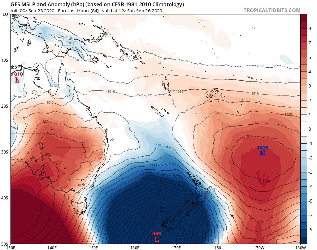
MAP ABOVE.
Low pressure anomaly for the weekend. Note the size and isobars = winds. Model, GFS.
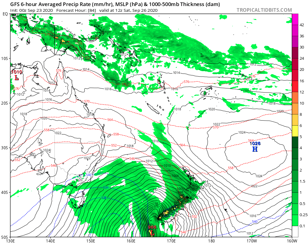
MAP ABOVE.
Rainfall intensity will increase Saturday night, as will winds across the region. Model,GFS.
•After full website access and our all member benefits, including discounts in our 2021 calendars? Join today for FREE – enter coupon code: SPRING at the check out to claim you free month of our ‘Basis’ membership.
© NZ Regional Weather Updates.