WHAT’S THE GO THIS WEEK? CONTRAST IN TEMPERATURES/CYCLONE TO THE EAST.
CONTRAST IN TEMPERATURES FOR CANTERBURY – WARMER FOR INLAND BASINS & AREAS.
High pressure will bring stable weather across New Zealand this week, with lighter winds and more sunshine hours for the Canterbury Region.
As is often the case during large anticyclones, we’ll experience areas of morning and evening lower and middle level cloud and onshore coastal winds.
For most towns and areas across the Canterbury Plains & Coast temperatures will peak around 19-22 degrees until the weekend, before we feel a small spike in temperatures, with most spots nudging 23-24 degrees.
For inland basins in the Mackenzie Country it’s looking superb all week, with quality sun, light winds and very warm temperatures. The likes of Twizel may experience a local heat wave, with temperatures set to push into the high twenties and early thirties for 5 days straight.
As a general rule if you’re chasing quality sun, lighter winds and milder temperatures our inland basins and areas will be the places to be!
Our picks for the week ahead – Twizel, Lake Tekapo, Lake Ohau, Castle Hill Village, Hanmer Springs, Lake Coleridge and Arthur’s Pass.
Keep up to date with our town pages for specific temperatures through the week. Care is required sourcing computer generated content which doesn’t take into account local micro climates. We specialise in highly accurate temperatures for over 27 towns across the region.

Map above – High pressure anomaly mid-week. ECWF.
CYCLONE THREAT?
We’re watching favourable conditions for tropical cyclone development in the South Pacific later this week.
While this system is appearing on current modelling it poses no direct threat to Canterbury and New Zealand at this stage and is likely to pass well to the east of New Zealand. A number of our friends in the South Pacific may receive stormy and possibly damaging conditions over this weekend.
Something to keep in mind for those heading to Fiji, or nearby islands.
At a push on current modelling we may see some stronger southerly/south-easterly winds for eastern parts of the North Island and larger swells; illustrated in our maps below.
If we see any changes; content will be adjusted accordingly.
A system to keep an eye on for all you weather ‘geeks’ which sure looks impressive on GFS & ECMWF modelling and maps. This system will lose it’s overall energy as it tracks into cooler waters late Sunday and Monday next week.

Map above – swells could be dangerous about eastern parts of the North Island early next week and we may even see some larger swells here in Canterbury. Note wind direction and wave significance.
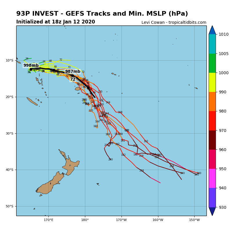
Map above – possible cyclone tracks, well east of New Zealand on current analysis.
© NZ Regional Weather Updates.