THE LOW DOWN FOR THE END OF THE WEEK – RAIN & SNOW ALL IN THE MIX.
Yes, our small window of fine weather departs tonight as our slim ridge of high-pressure drifts away to the east. We say goodbye to the sun as an extended period of cloudy, wet and cold weather takes aim for the remainder of the week.
A large area of low pressure moves in on Friday and dominates New Zealand’s weather for the remainder of the week with a number of fronts bringing widespread rain and snow to higher elevations.
Here in Canterbury conditions will deteriorate through Friday morning with scattered rain, some steady falls in the mix and perhaps even some isolated ‘pockets’ of heavier rain through the day.
Colder south-easterlies become established and strengthen on Saturday with heavier rain setting in and lowering snow levels; possibly to around 900m for a time. Please note this isn’t a low level snow event. Conditions will slowly ease back from the south on Sunday but we can still expect steady and possibly heavy falls for parts of the region (Mid & North Canterbury.)
Overall some much needed rain for eastern areas after what’s been a very dry first half of July and some fantastic snowfall accumulations for our eastern fields; potentially significant depending on the exact ‘feed zone’.
At this stage the likes of Mt Hutt, Porters, Mt Dobson and Mt Lyford could well receive significant snowfall accumulations by Sunday evening.
While this is a widespread period of cold and wet weather we continue to watch and pin point exactly where the heavier falls will occur. Earlier data and computer guidance suggested North Canterbury & the Kaikoura District while the trend in the last 48 hours has been favourable towards heavier and more sustained falls in southern parts of the region. This remains a ‘fluid’ situation this evening.
All in all, get ready for a very cold and wet end to the week. Remember to keep up to date with our town forecasts for specific rainfall totals and snowfall accumulations and our ‘Live Weather feed’ for all the latest information.
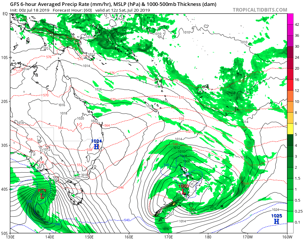
Map above.
A GFS representation of the weekend – note the southeast ‘feed’ and positioning of the low. Source – www.tropicaltidbits.com
Photo attached to the article – archive photo of Broken River Ski Area.
© NZ Regional Weather Updates.
AFTER FULL WEATHER COVERAGE? JOIN TODAY AND RECEIVE ONE OF OUR MEMBERSHIP CARDS FOR FREE.
WE ALSO HAVE 2 AMAZING GIFT PACKS AVAILABLE FOR CURRENT & NEW MEMBERS THAT SIGN UP IN JULY.
CHECK OUT THE PRIZES & OUR MEMBER BENEFITS BELOW.