Labour Weekend – all four seasons?
Yes, as we move closer to the long weekend, the questions are flooding in! What’s in store, we can now ‘lock in’ Saturday and Sunday, but we may see some slight changes, with Monday remaining ‘fluid’ in terms of rainfall totals.
SATURDAY
A superb day. Mostly sunny day across the Canterbury Plains & Coast, with variable high cloud developing late in the day. Northerlies early on about the coast, tending nor-west by evening. Strong nor-westerlies about the hill country, with showers setting in about the Main Divide/Headwaters.
Warm temperatures out east, with temperatures hovering between 23-26 degrees, some far eastern spots may challenge 27-28 degrees.
The best day across the region over the long weekend.
SUNDAY
Rain about the Main Divide/Headwaters, becoming heavy from evening, high intensity falls overnight, with rates exceeding 15mm/hr. We may issue a heavy rain warning for the Main Divide/Headwaters as we move into later stages of the week. Strong to gale force nor-westerly winds about the hill country.
Mostly fine, with high cloud, often extensive across the Canterbury Plains & Coast, with some sunny spells. Nor-westerly winds, strong at times, possibly gale about the foothills and high country, building through the afternoon.
Warm temperatures out east, with temperatures hovering between 23-26 degrees, possibly slightly warmer about eastern parts of North Canterbury around midday.
Colder southerlies and rain develop late at night, moving north overnight.
MONDAY
A cloudy, cool and wet day across the region at this stage. We currently have specific rainfall totals on town pages, but we may see changes over the next few days. Rainfall totals have gone up significantly on the latest analysis.
Overall a cooler day, with more cloud and rain potential across the entire region.
Temperatures between 14-16 degrees at this stage.
MAPS OF INTEREST.
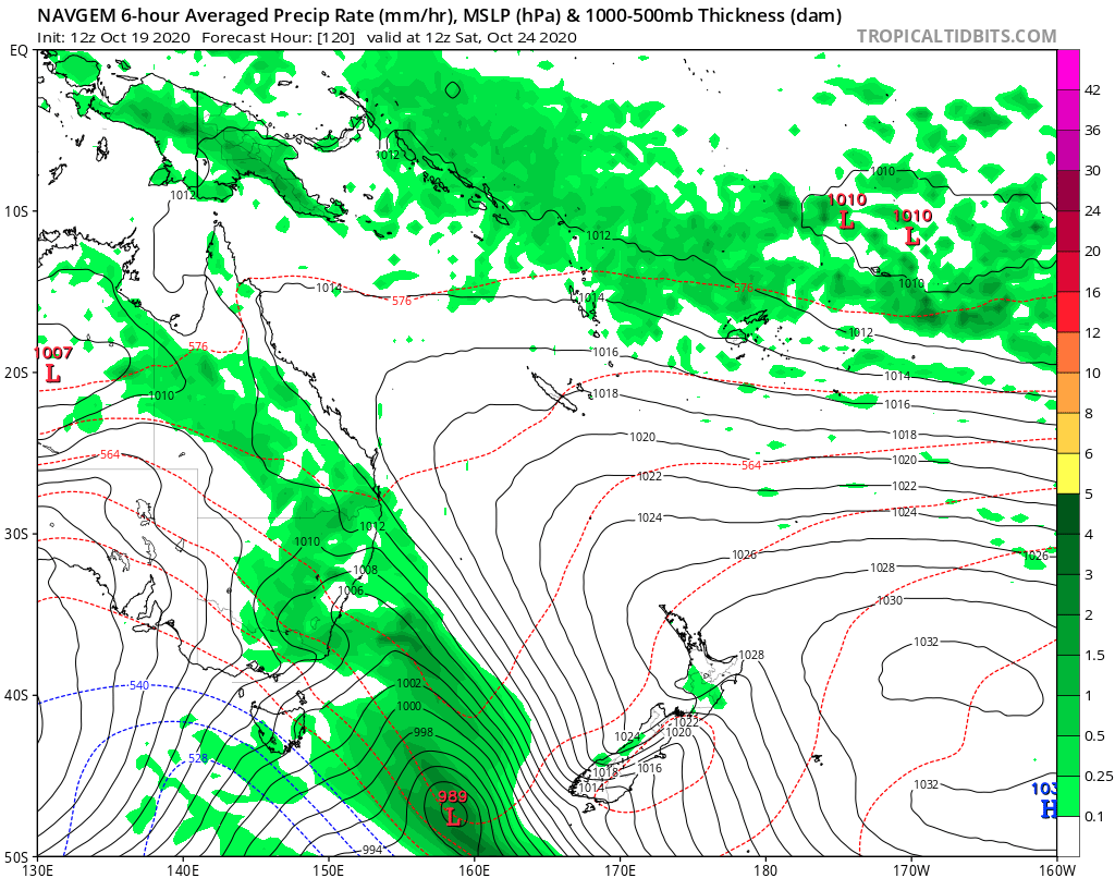
MAP ABOVE.
Saturday – check out those isobars – warm air currents from the sub tropics/foehn winds = very warm temperatures out east, with minimal high cloud. Our rain maker fast approaching from the west.
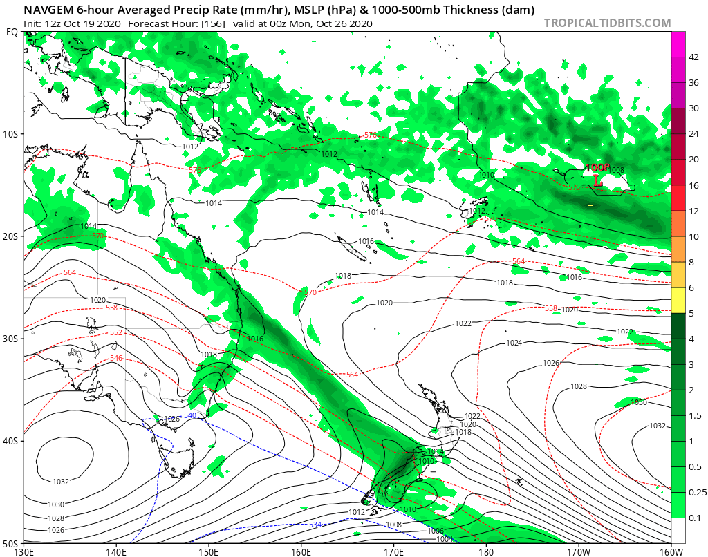
MAP ABOVE.
Colder southerly flow on Monday may bring widespread rain possibly heavy, if we see some mixing and mingling with warmer tropical air. Rainfall totals remain fluid for Monday.
© NZ Regional Weather Updates.
Try our ‘Basic’ membership FREE for the first month, then an easy recurring $3.99 a month and enjoy all the latest weather information and benefits perks across Canterbury.
•Enter coupon code: SPRING at the checkout claim.