IMPRESSIVE CYCLONE SET TO PASS TO THE NORTH & EAST OF NEW ZEALAND.
SUMMERY WEATHER HERE TO STAY – FOR NOW.
Our summer is finally starting to kick into gear, with high pressure domination this week. While onshore easterlies have confined temperatures about Coastal Canterbury, our inland basins have basked in quality sun, light winds and warmer temperatures.
Next week anticyclonic weather remains in control bringing mostly sunny skies and pleasant temperatures for the Canterbury Plains & Coast, with temperatures set to push into the early to mid-twenties.
Our inland basins in the Mackenzie Country look set to sizzle; in fact, Twizel may nudge 30 degrees 6 days straight from tomorrow.
Collectively next week could be one of our hottest weeks this summer in Canterbury; especially for those through the Interior and Mackenzie Country – keep in mind we still have our more traditional warmer month of February to come.
For those keen swimmers; our sea temperatures will continue to rise, especially during later stages of next week. Our best swimming is yet to come.
We start to see changes late in the month, with more system frequency in the Tasman = more rain potential for the Main Divide & Canterbury Headwaters.
Source our town pages for specific temperatures over the next 7 days – there will be significant contrast.
TROPICAL CYCLONE OF INTEREST.
As this impressive system slides to the south-east it will generate impressive swell systems and waves to parts of New Zealand. Coastal and eastern parts of the North Island will be most exposed, but we may even see some impressive and possibly dangerous waves about Canterbury for a time on Monday.
Something to keep an eye on.
Those heading to the Pacific Islands, keep up to date with the Fiji Meteorological Service, which will be covering this storm extensively. Slips, flooding, wind damage and dangerous seas are distinct threats.
MAPS OF INTEREST.
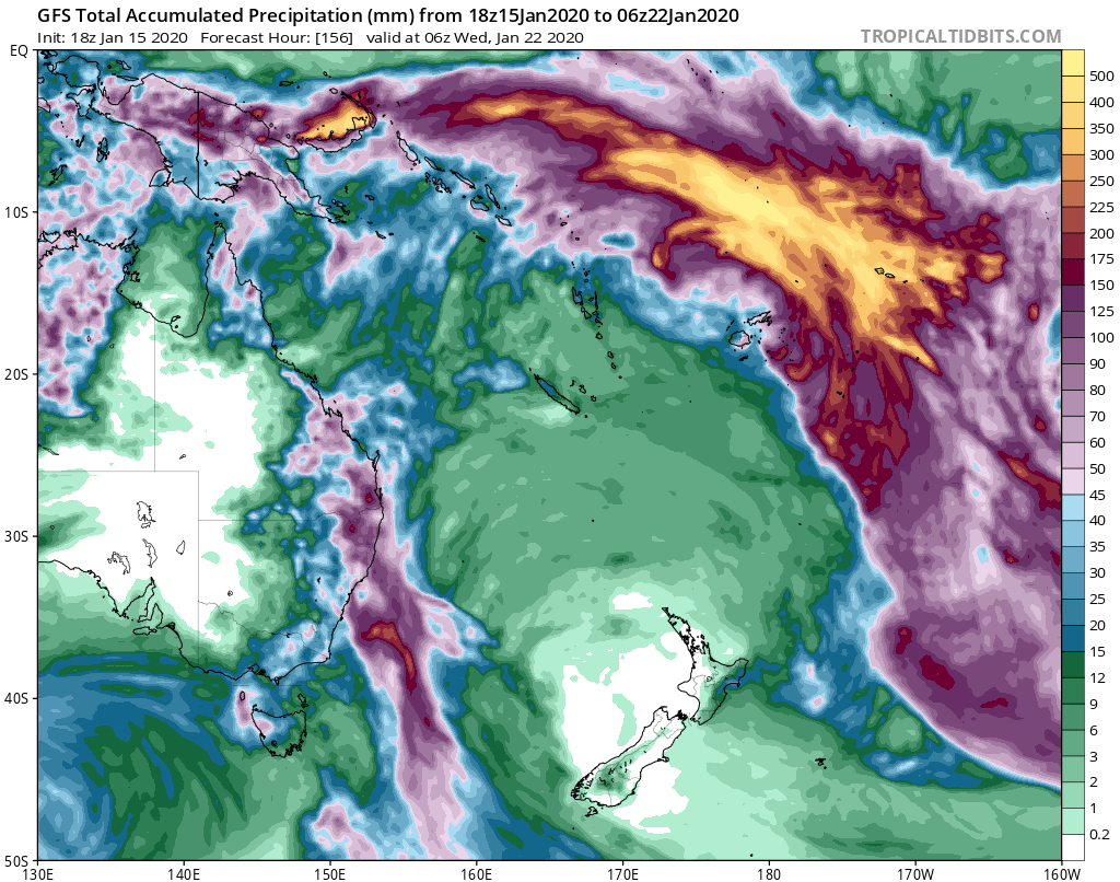
An impressive moisture ‘river feed’ the end result of our passing cyclone – total rainfall by early next week.
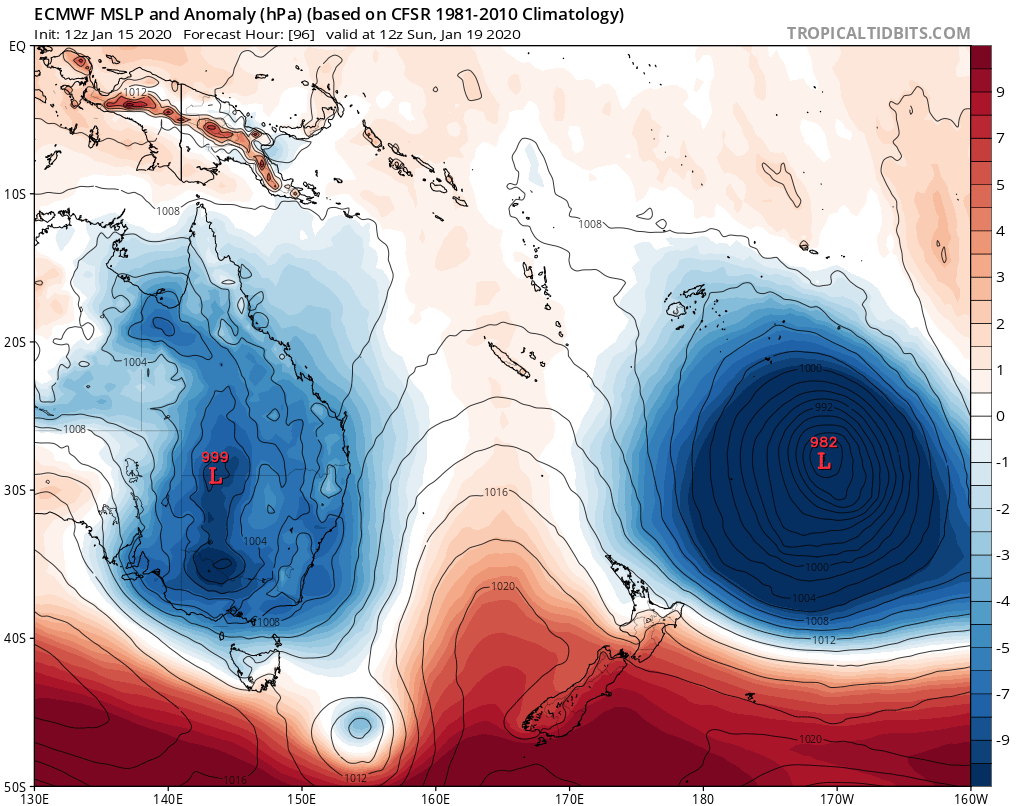
A large area of low pressure to the north east of New Zealand. Our weather will be largely dominated by high pressure here in New Zealand despite impressive swells.

Significant waves off to the East Coast of New Zealand; please note we may see slight changes in the path and more influence in New Zealand regrading swell severity.

GFS and ECMWF are on the same ‘wave’ as are almost all our model that this system will pass well to the north east of New Zealand
Maps – courtesy of https://www.tropicaltidbits.com/
© NZ Regional Weather Updates.