


HEAT WAVE LIKELY FOR PARTS OF CANTERBURY NEXT WEEK.
HEAT WAVE SET FOR PARTS OF CANTERBURY NEXT WEEK.
It’s been a cooler start to the year, with a prolonged period of south-westerly winds.
Next week high pressure takes charge with more summer like conditions across New Zealand; yes, more of our traditional summer weather in New Zealand! At long last.
Bar areas of morning low cloud, inland basins and areas of the region look set to sizzle, with sunny skies and light winds set to dominate.
At this stage the Mackenzie Country and perhaps inland basins such as Hanmer Springs look set to experience the warmer temperatures. While large areas of high pressure and temperatures in the high twenties and early thirties aren’t unusual for January; it will come as a bit of a shock to the system for a number of cooler and unsettled weeks.
While our inland basins look set to sizzle, cloudy periods and onshore winds will moderate temperatures about the Canterbury Coast and the lower Canterbury Plains, with temperatures confined to the early twenties.
Some of our warmer spots next week will include – perfect for those still on holiday in the Mackenzie Country.
Twizel, Hawarden, Hanmer Springs, Castle Hill Village, Lake Coleridge, Lake Ohau, Lake Tekapo, Lake Pukaki and Omarama.
The hottest day? Possibly Thursday afternoon or Friday for the likes of Twizel and Hanmer Springs fighting it out for top honours, with 30-32 degrees possible.
Keep up to date with our town pages for specific conditions and temperatures which provide the most moderated and personalised content available for Canterbury.
What is a heat wave?
A heat wave occurs when the daily maximum temperature exceeds the average maximum temperature by five degrees or more for five consecutive days. When we talk about the “average maximum temperature”, we are referring to the average for a specific location, and for a specific time of year.
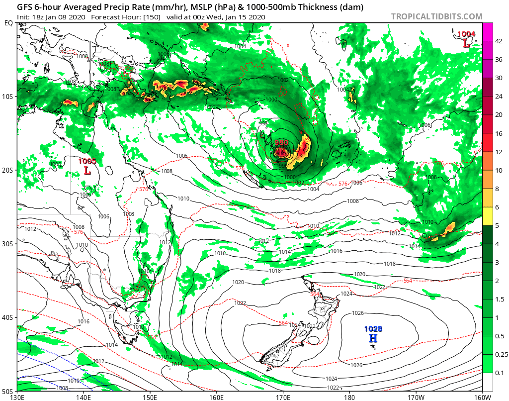
MAP ABOVE.
High pressure will take centre stage; notice our distinct low in the north; this may move south and bring some much needed rain to parts of the country later next week; higher risk about Northland and eastern parts of the North Island. Model GFS.
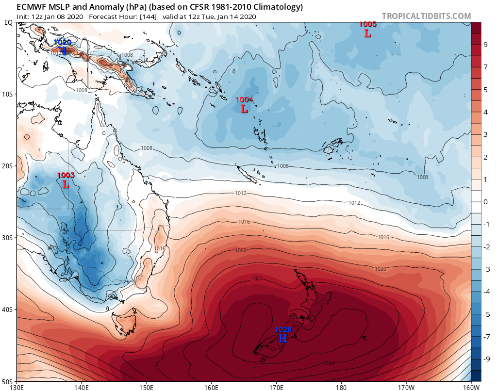
MAP ABOVE.
High pressure anomaly during middle stages of next week. ECMWF.
© NZ Regional Weather Updates.


Bev Parkes 9th January
Great info love the maps
Richard 9th January
Sounds like great harvest weather around the corner just what’s needed.