LOW SET TO DELIVER HEAVY RAIN, WITH MORE FLOODING POTENTIAL & ROAD CLOSURES IN THE KAIKOURA DISTRICT
BRIEF SUMMARY – Our low remains on track for tomorrow and moisture levels continue to sky rocket for an extended period of time. Most, if not all of Canterbury will surpass last week’s rainfall totals, including areas that exceeded very healthy totals of 60mm +.
This low is unique on many levels, possibly what really stands out is the duration of rain, with this system really ‘stalling’ over central parts of New Zealand & feeding in rain, with cooler SE winds for over 50 hours. Conditions will start to deteriorate on Wednesday morning, with steady rain for many areas by the afternoon, but our real focus is on Thursday & overnight into Friday morning when this system really ramps up, with significant rain and heavy falls across Canterbury. When it comes to your traditional rain events in Canterbury, those SE, easterly winds are the main dominating winds, especially about the Eastern Foothills, Plains & Christchurch.
Pin pointing worst hit area remains a tricky proposition, with constant shifts between South, Mid & North Canterbury, at this stage it’s looking like a widespread event which will affect the entire region; perhaps more South Canterbury tomorrow night & then into Thursday & Friday morning for areas north of Ashburton. We can expect to see surface flooding in flood prone parts of Christchurch once again, at this stage rainfall totals look higher than last week and the share intensity of rain will be more of a concern as we move into Thursday afternoon & evening. The Kaikoura District is likely to receive the heavier rain Thursday afternoon, through to around mid- morning on Friday, posing more concerns around slips, surface flooding and more headaches for holiday makers and road crews using SH1 to the north & south.
January is off to an unbelievable start, with many areas looking at over 140mm in the first 2 weeks! Christchurch looks on track to record 100mm by the 12th of January; on average Christchurch receives around 50mm during the duration of January. Our ‘Monthly Outlook highlighted the change of an increase in system frequency & rain events, but even where surprised to this dramatic increase in rain activity.
IMAGES: We use a range of models, maps and data sets. GFS are widely used and respected & do provide a great source of information, especially closer to an event of interest. Source: https://www.tropicaltidbits.com/
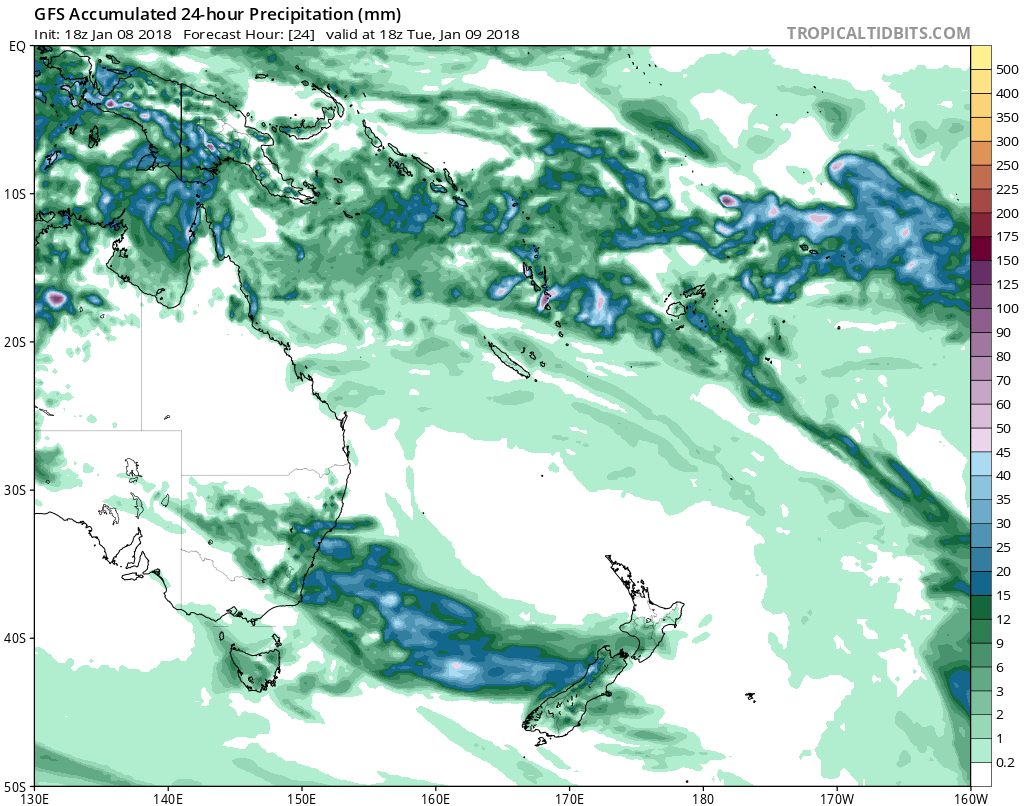
Current situation – our Low on track in the Tasman, note the origins and ‘path’ over are warmer waters, essential and maintaining high moisture content. Graphic illustrates 24 hour rainfall in (mm)
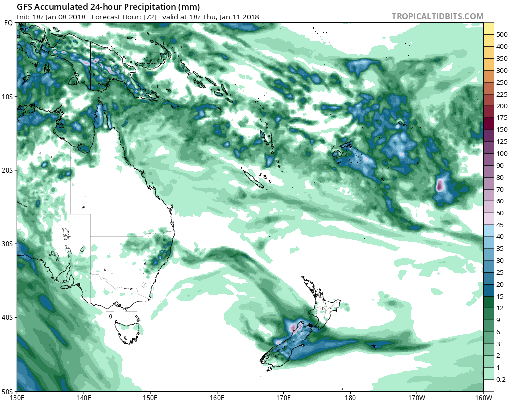
The position of our low on Thursday as it take firm control over central parts of New Zealand, producing heavy rain across the top half of the South Island and bottom half of the North Island. Graphic illustrates 24 hour rainfall in (mm)
We currently have a ‘Watch’ in place with more details. All our town forecasts are now updated, answering your questions with specific, detailed information. If you’re after a little more than ”Rain developing, with southerlies” you’ll love the extra clarity & confidence our forecasts provide.
Keep up to date with Canterbury Weather Updates – unmatched intensity, detail and accuracy for 23 towns across the region. For those that haven’t jumped on board, join now, FREE for the first month, cancel anytime @ https://cwu.co.nz/membership-account/membership-levels/
Weather Analyst: Russell Voice